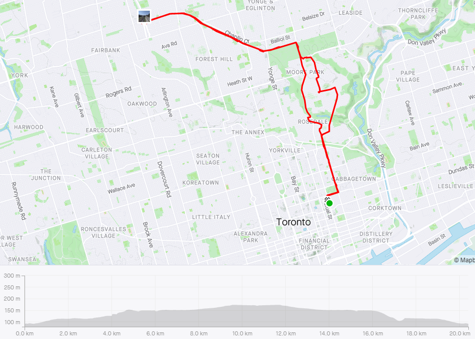

This route goes through the quaint Rosedale and Summerhill neighbourhoods, including a pedestrian bridge crossing over CPR tracks, and joins onto the Kay Gardner Beltine Trail at Mount Pleasant Cemetery, where the trail becomes a nice gravel. It is suitable for cruisers or road bikes with thicker wheels.
The route generally climbs uphill until Davisville. Enjoy a rewarding descent flying down Mount Pleasant Road during your return. At the north end of the trail you can also bike over to Marlee Ave. to join onto the paved York Beltline Trail. The Beltine Trail does continue to loop south of the cemetery in conditions more suitable for mountain bikes.
Special notes:
After turning right onto Mount Pleasant Road headed north, take a right into Mount Pleasant Cemetery and then a left. You will be able to bike under the bridge and meet the entrance to the Beltline Trail, bypassing traffic and stairs. This option is only available when the cemetery is open.
Watch for pedestrians on the Beltine Trail.
The west lanes of Mount Pleasant Road have some bumps until the main descent, where it becomes smooth. The road is unprotected and can be busy during rush hour, but there are two lanes and cars generally have space to pass.
When nearing the bottom of the Mount Pleasant hill, make sure to shift down and prepare to ascend quickly as the hill goes up.
- Round trip distance: 20 kilometres
- Difficulty: 3/10
- Estimated round trip time: 1:15 hours
- Paved? 50%
- Scenic rating: 3/5